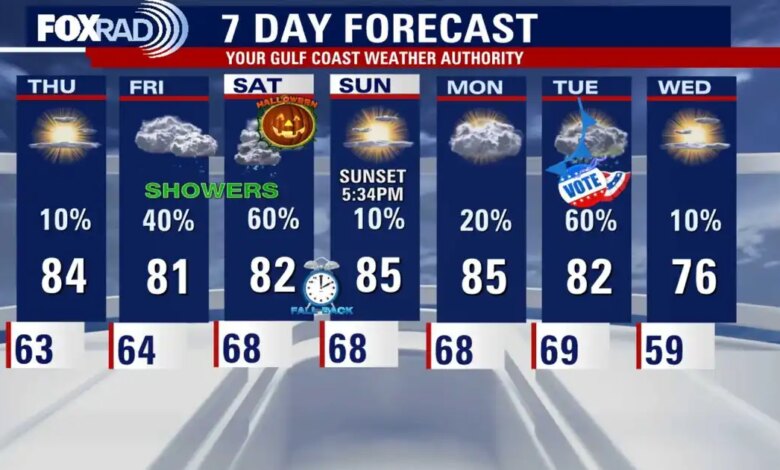
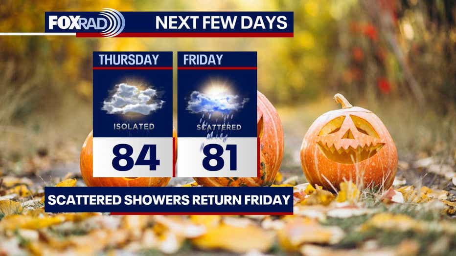
Houston residents are seeing warmer conditions on Thursday with afternoon highs reaching the mid-80s alongside only a slight chance of precipitation. However, atmospheric conditions are shifting as the week progresses, introducing multiple rounds of unsettled weather just in time for major weekend and early-November events.
More consistent shower activity is expected to return on Friday, with precipitation concentrating particularly during the afternoon and evening hours. This moisture sets the stage for a tight forecast window on Halloween night.
alloween itself is shaping up to be a close call for local trick-or-treaters. Forecasters note that scattered showers and a few isolated thunderstorms remain possible as children head out into neighborhoods. Whether the wet weather manages to clear the area entirely before evening festivities remains uncertain, though current meteorological models indicate that showers should gradually taper off as night falls.
Looking further ahead into early next week, meteorologists are tracking a significant cold front projected to slide into the Houston region by Tuesday, November 3rd, coinciding directly with Election Day. The timing of the front raises potential concerns that adverse weather could impact voter turnout at the polls.
The incoming system carries a substantial chance for morning showers and thunderstorms that could linger well into Tuesday afternoon. Daytime temperatures on Election Day are expected to hover near 80 degrees before a sharp drop pushes readings down into the 50s behind the front by Tuesday night. Even cooler air mass conditions are slated to settle over the region by Wednesday.