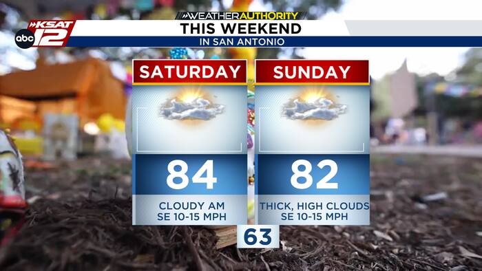
Residents across Texas are enjoying a calm, dry weekend under the influence of high pressure, but forecasters warn that a shift toward a more active weather pattern is right around the corner. The current weekend setup features a pleasant mix of sun and clouds, with high clouds expected to move into the region by Sunday. Afternoon temperatures are holding steady in the low to mid-80s, providing comfortably warm conditions. Sunday may run a degree or two cooler as increased cloud cover moves across the area, though the weekend overall remains entirely rain-free.
That tranquil stretch will begin to break down early next week as a weak disturbance approaches the region. Forecasters indicate that light showers could develop as early as Monday night and linger into Tuesday. Severe storms are not anticipated with this initial system, and overall rain chances remain limited to a few spotty showers.
Looking further ahead into the latter half of the week, atmospheric moisture levels are expected to rise, bringing better opportunities for measurable precipitation by Thursday and Friday. While rain chances are increasing for late next week, meteorologists note that heavy rainfall is currently not expected. Attention is also turning toward Halloween night, where early indications suggest rain chances are trending lower, though forecasters emphasize that the forecast remains fluid and subject to change as new data arrives.
The extended outlook calls for a continuation of mild to warm daytime temperatures stretching well into next week. Afternoon highs will generally range from the upper 70s to the mid-80s, accompanied by comfortable and slightly humid overnight lows settling in the mid-50s to mid-60s. Residents are encouraged to enjoy the quiet weekend conditions before the more unsettled weather pattern establishes itself later in the week.