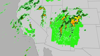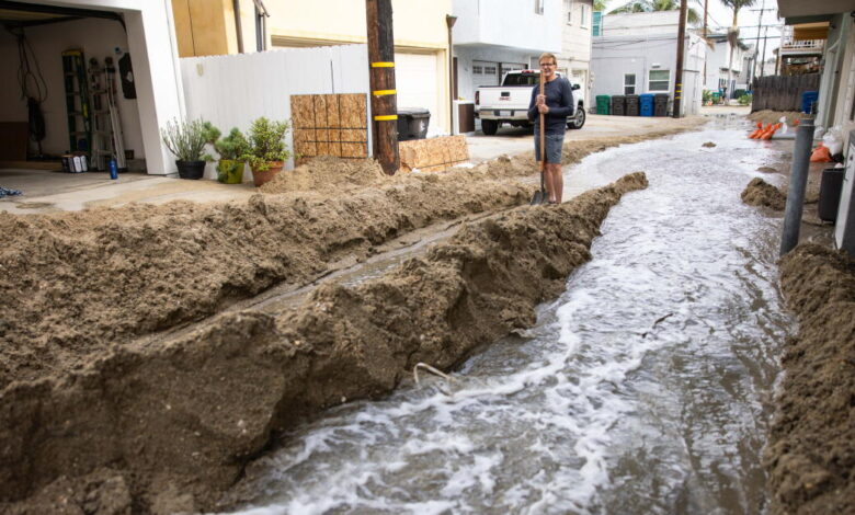
A series of El Niño-fueled storms soaking Southern California has closed roads, caused localized flooding, and eroded beaches across the region, while also bringing a potential silver lining in the form of a dampening effect on the local fire season.
The storms, which arrived Wednesday, brought localized flooding to several major freeways by Thursday morning. According to the National Weather Service, affected routes included parts of Highway 101 in Los Angeles and Ventura counties and Highway 1 in San Luis Obispo County. In the Central Coast region, boulders blocked a road near Agua Dulce, while a rock slide obstructed a section of Highway 41.
Additional rainfall across the Southland raised concerns about potential debris flows over local burn scars. Forecasters also warned of the possibility of thunderstorms and a small chance of a tornado forming in Ventura or Los Angeles counties before conditions are expected to dry out by the weekend.
Matt Shameson, a meteorologist with the U.S. Forest Service, noted that across much of the Inland Empire as well as San Diego and Orange counties—where 1 to 3 inches of rain fell from the remnants of Tropical Storm Rachel earlier this month—the current storms will likely quell the risk of large fires for the remainder of the fall.
However, the outlook differs for Los Angeles and Ventura counties, where most areas received less than a tenth of an inch of rain from Rachel. Shameson explained that another round of precipitation will be necessary to officially end the fire risk for the rest of the season in those counties. While light vegetation such as grass and brush can quickly cure into fire-ready tinder under the right conditions, particularly during hot and dry Santa Ana winds, Shameson noted that such conditions are unlikely to materialize before another rain event occurs. Furthermore, Santa Ana winds forecast for Friday into Saturday are not expected to be particularly strong or widespread.
Southern California’s fire season typically peaks in July and August, when each day averages a roughly 22% chance of significant fire activity, according to Shameson. By October, that probability drops to about 5%. Once the calendar reaches the middle of September, significant fire activity generally requires a Santa Ana wind event.
Recent years have demonstrated the destructive potential of late-season Santa Ana winds mixing with dry conditions, including the Norte fire in Orange County, which destroyed seven structures, alongside the 2025 Los Angeles firestorm and the Mountain fire in Ventura County months prior. Stronger Santa Ana winds typically arrive in the winter, and when preceded by sufficient rains, the risk of large fires is significantly dampened. Shameson stated that achieving this effect usually requires two widespread rounds of moderate to significant rains, noting the potential for another storm late next week, though he cautioned it remains too early to confirm.
Despite the positive moisture trends, local officials urge caution. David Acuña, a battalion chief with the California Department of Forestry and Fire Protection in Sacramento, warned that areas receiving minimal steady precipitation remain vulnerable. “I hate to be a negative person,” Acuña said. “It’s just a matter of I don’t want people to let their guard down.”
A historically strong El Niño increases the likelihood of above-normal winter precipitation in Southern California by raising the frequency of storms and ensuring they carry more warmth and moisture. Shameson added that anomalously high sea surface temperatures driven by El Niño, combined with a marine heat wave and climate change-induced warming, have driven an increase in the remnants of hurricanes and tropical storms reaching the region over the past three or four years, compared to a normal historical pace of every five to ten years. These systems, including Hurricane Marie last month, have helped increase moisture levels in plants and soils while alleviating drought conditions.
According to the state Department of Water Resources, California received 22.61 inches of precipitation during the 2025-26 water year ending September 30, reaching about 95% of its historical average. Jay Lund of the UC Davis Center for Watershed Sciences noted that this followed near-average water years in 2023-24 and 2024-25, marking the longest run of near-average years since the 1990s, although the state snowpack remained well below average.
With ongoing rains and forecasts for a wet winter, authorities are also preparing for a different hazard: flooding and debris flows in burn scar areas. Wildfires can alter soil composition by creating a waxy, hydrophobic crust from vaporized organic matter that repels water, causing heavy rain to run off the surface instead of absorbing.
As El Niño storms are expected to intensify beginning in December, Acuña expressed concern over whether drainage systems can safely handle rapid water movement or if intense downpours will generate new hazards. In response, the Los Angeles Fire Department has augmented its resources for swift-water rescues and mudslide response, focusing heavily on burn scar zones, according to a statement from Mayor Karen Bass. City crews have also cleared more than 31,000 catch basins and drainage systems while inspecting and reinforcing vulnerable hillsides in areas such as Pacific Palisades.