
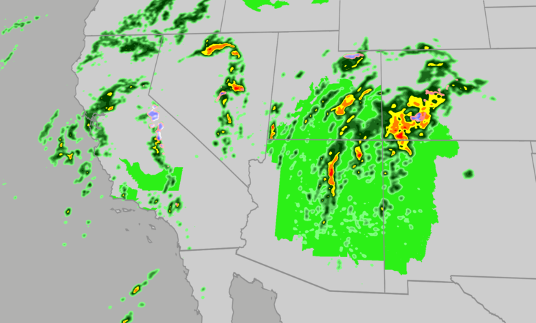
Millions of residents across seven states stretching from California to Colorado face a mounting threat of severe weather, flash flooding, and mudslides this week as an influx of tropical moisture collides with saturated regional soils. The active weather pattern, which began bringing heavy bands of rainfall and severe storms to parts of California and the Four Corners region, is expected to persist and intensify, raising concerns for communities and visitors alike.
Forecasters note that the atmospheric conditions are channeling deep tropical moisture into the Southwest, creating an environment favorable for heavy precipitation. Some forecasting models suggest the region could experience near-record levels of moisture availability for the month of October. This abundance of moisture increases the likelihood that final rainfall totals could exceed current projections, heightening the overall flood risk on soils that are already thoroughly saturated.
The primary flood threat extends across Arizona, Nevada, New Mexico, Colorado, and Utah, with major metropolitan areas including Las Vegas, Phoenix, Tucson, and Albuquerque within the impacted corridor. Among the most pressing concerns for local emergency management are potential mudslides and debris flows over recent burn scar areas, as well as dangerous flash flooding in vulnerable slot canyons and arroyos. Authorities advise travelers planning visits to western national parks this week to monitor daily forecasts closely and adhere strictly to local warnings and advisories.
In addition to widespread flooding, an enhanced threat of severe weather accompanies the system. Isolated storms capable of producing strong damaging winds, large hail, and even tornadoes are anticipated across portions of the Desert Southwest and the Four Corners region, with Arizona facing the highest relative risk.

Severe weather activity was already evident as storms swept through the area. Downtown Flagstaff reported hail reaching 1.75 inches in diameter, matching the size of a golf ball, on Wednesday. Concurrently, the Flagstaff Airport recorded a powerful wind gust reaching 72 mph. The atmospheric environment also prompted authorities to issue a tornado watch for northern Arizona, marking the first such watch declared for that area in more than 16 years.
Precipitation totals from the multi-day event are projected to reach up to 3 inches across portions of the Desert Southwest, with isolated locations potentially receiving as much as 5 inches. Such amounts are more than sufficient to trigger dangerous flash floods in the arid terrain. Meanwhile, higher elevations in parts of the Sierra Nevada and the Rocky Mountains are experiencing the first significant snowfall of the season. While widespread accumulation totals are expected to remain under 6 inches, isolated peaks could see up to a foot of snow. This early accumulation may provide a helpful snow base for regional ski resorts following lower snowfall totals last winter. Officials caution travelers traversing mountain passes to remain alert, as rapid transitions from heavy rain to accumulating snow can create hazardous driving conditions.