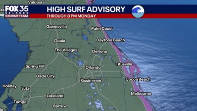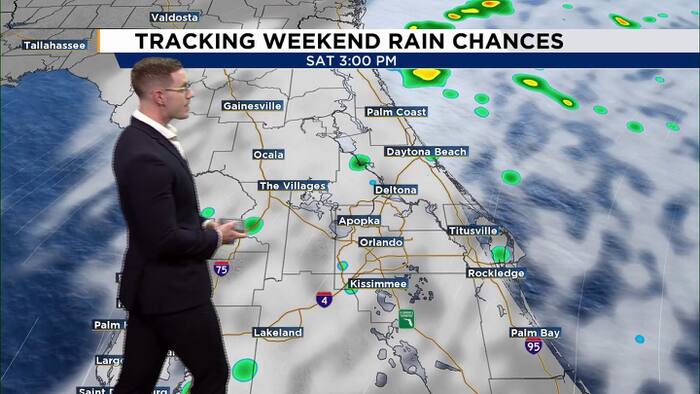
Central Florida is bracing for a weekend of hazardous weather as a combination of strong northeast winds, heavy rain, and dangerous maritime conditions takes aim at the region. Weather officials have issued a series of advisories and watches for the Atlantic coast, warning residents and visitors that conditions will deteriorate significantly starting Saturday and peak on Sunday.
The unsettled pattern began Friday evening with a relatively cool night across the interior, where temperatures dropped into the low to mid-60s. Coastal areas remained slightly warmer, hovering between the mid-60s and lower 70s. While most of the region stayed dry through Friday night, scattered showers began moving onshore along the beaches, signaling the start of a wet and windy stretch.
On Saturday, the weather is expected to intensify as northeast winds increase to sustained speeds of 15 to 20 mph, with gusts reaching up to 35 mph. While daytime highs will climb into the upper 70s and lower 80s, the day will be characterized by increasing cloud cover and passing showers. The most severe impacts on Saturday will be felt along the shoreline. A Coastal Flood Advisory is currently in effect for portions of the coast, while a Coastal Flood Watch has been extended into Monday morning. These warnings come as strong winds and higher astronomical tides threaten to push seawater into low-lying areas, causing beach erosion and localized flooding.
Boaters are facing particularly treacherous conditions. A Small Craft Advisory is currently active for Atlantic waters, and Gale Watches are scheduled to take effect late Saturday into Sunday. Mariners should expect building seas that will make navigation difficult and dangerous through the early part of next week.
Sunday is forecast to be the most severe day of the weather event. Forecasters expect northeast winds to strengthen to 20 to 25 mph, with gusts potentially hitting 45 mph. These conditions may prompt official wind advisories for inland and coastal counties alike. Rain chances will jump to 70% or 80% along the coast, with scattered thunderstorms possible as the moisture pushes inland. The Weather Prediction Center has designated much of the coastal area under a Level 1 out of 4 threat for excessive rainfall, warning that repeated rounds of heavy showers could lead to localized flooding in areas where rain bands stall.
The surf will be especially dangerous on Sunday, with breaking waves projected to reach heights of 7 to 12 feet. Officials have warned of a high risk of rip currents and have strongly discouraged entering the ocean. Even walking along the beach could prove hazardous, particularly during high tide on Sunday and Monday morning, when large waves are expected to push significantly farther up the shoreline than usual. Offshore, wave heights could reach 12 to 15 feet by Sunday night.
Looking ahead to next week, the region will remain breezy, though the intensity of the rain is expected to diminish. Gusty northeast winds will persist into Monday alongside quick-moving coastal showers. While inland conditions are expected to stabilize by mid-week, hazardous surf and boating conditions are likely to linger. Afternoon temperatures throughout next week are forecast to stay near 80 degrees, keeping Central Florida slightly cooler than the historical average for late October. Persistent northeast winds will continue to keep the threat of beach erosion and minor coastal flooding active well into the new week.