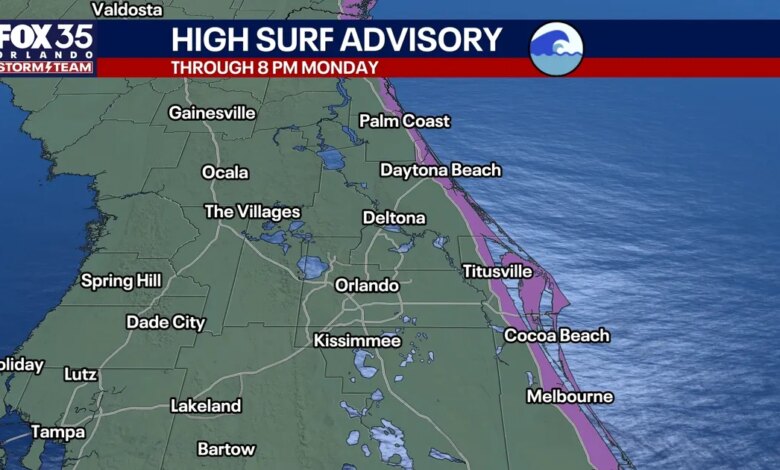
Central Florida residents and visitors are facing a weekend of hazardous coastal conditions and gusty winds as a weather disturbance circulating offshore creates a tight pressure gradient across the region. The atmospheric setup, characterized by high pressure anchored over the eastern United States and lower pressure over the Atlantic, is driving a persistent onshore flow that has prompted several marine and coastal warnings through Monday.
The most significant threats are concentrated along the Atlantic coastline, where a Coastal Flood Warning is now in effect. Officials have cautioned that flooding is likely in flood-prone areas near the intracoastal and local beaches. Additionally, a High Surf Advisory remains in place through Monday as the persistent northeast-to-east winds generate large, pounding waves. In the Gulf Stream, seas are expected to build between 10 and 15 feet, leading to a Gale Warning for offshore waters.
Beachgoers are being urged to stay out of the water entirely. The combination of rough surf and strong onshore winds has created a high risk for life-threatening rip currents and minor beach erosion, particularly during periods of high tide. The conditions make for dangerous boating and swimming environments across all coastal communities in Central Florida.
Inland, the Orlando metro area is experiencing sustained northeast winds of 15 to 20 mph, with gusts reaching between 25 and 30 mph. These winds are steering fast-moving bands of scattered showers across the peninsula. Rain chances are currently hovering around 50% for coastal areas and 30% for the interior. While these showers are expected to be brief, they are capable of producing localized downpours and sudden wind gusts.
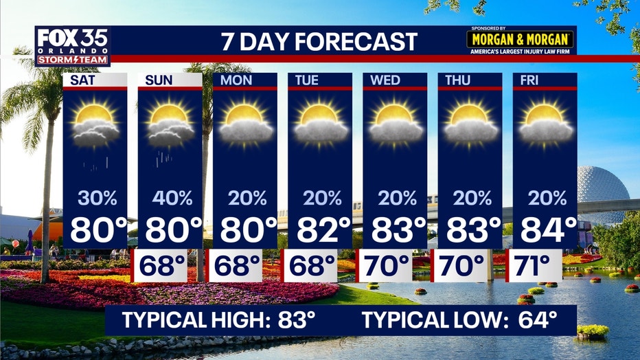
Despite the blustery conditions, temperatures remain relatively pleasant. Highs in the Orlando metro and interior counties are topping out in the lower 80s, while coastal areas remain slightly cooler in the upper 70s to around 80 degrees due to the steady ocean breeze. Humidity levels have climbed slightly compared to earlier in the week, though midday heat indices remain manageable. Overnight, temperatures are expected to drop into the mid-to-upper 60s in the metro, while northwest counties such as Marion, Lake, and Sumter will see cooler lows in the lower to middle 60s.
Looking ahead to next week, weather patterns are expected to shift as drier mid-level air moves into the region. This transition will lead to more sunshine and a reduction in rain chances to approximately 20%. While the humidity will linger, the overall pattern suggests a move toward drier conditions after the weekend disturbance passes.
Regarding tropical activity, the Atlantic basin currently remains tranquil. Despite the offshore disturbance, the National Hurricane Center indicates no tropical cyclone development is expected in the Gulf, Caribbean, or local Atlantic waters over the next seven days. High levels of wind shear and pockets of dry air are currently suppressing any organized tropical systems, leaving the U.S. coastline free of tropical threats for the immediate future.