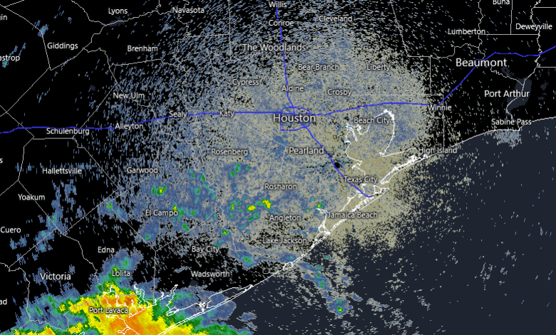
Houston and the surrounding region are entering a period of unseasonable warmth and rising humidity that will persist through the Halloween weekend. While several rounds of spotty showers are possible over the coming days, the most significant shift in the weather pattern is not expected until the middle of next week, when a strong cold front is projected to move through Southeast Texas.
Weather conditions on Tuesday began with rain showers concentrated well to the southwest of the city, specifically near Port Lavaca and Indianola. These showers have been slowly tracking to the northeast toward Matagorda. While Harris County and its immediate neighbors face only a 10 to 20 percent chance of seeing this activity spill into the metropolitan area, an increase in atmospheric moisture is expected to break the recent trend of full sunshine, bringing partly cloudy skies and highs reaching approximately 80 degrees. Tuesday night will remain warm, with lows only dipping into the upper 60s.
The warming trend continues into Wednesday, with temperatures expected to climb into the low-to-mid 80s under partly to mostly sunny skies. Rain chances remain low, held at a 10 to 20 percent probability for the Houston area. Residents may find brief relief from the humidity on Thursday. A shift to a northeasterly wind flow is expected to pull drier air into the region, which could lower humidity levels significantly by Thursday evening. This temporary dry spell may allow Thursday night lows to drop into the lower 60s, though daytime highs will still hover in the lower 80s.
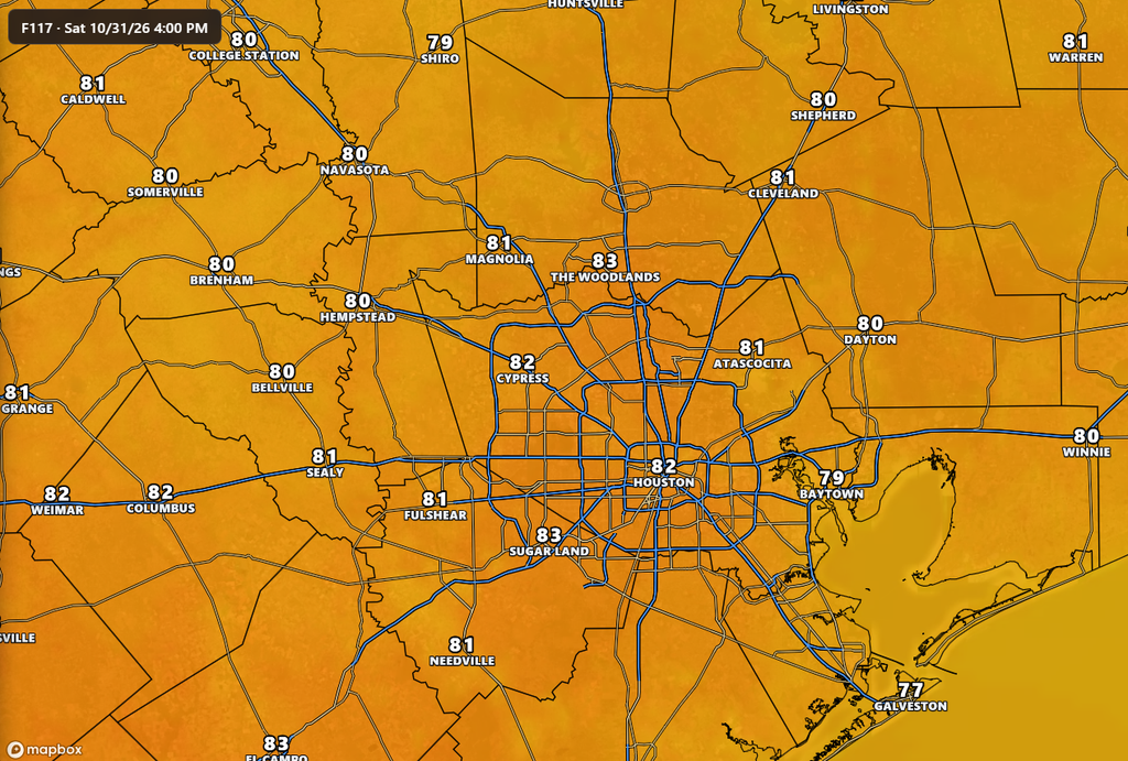
The outlook for the Halloween weekend suggests a return of atmospheric moisture starting Friday. While Friday will see highs of around 80 degrees and sunny skies, a 20 percent chance of rain is forecasted for the afternoon and evening hours. Saturday, Halloween, may see more cloud cover and higher temperatures in the low-to-mid 80s. Despite a 40 percent chance of rain on Saturday, current models indicate that shower activity should dissipate by the late afternoon, leaving the evening hours clear for trick-or-treating activities. Sunday is expected to remain warm for early November, with mostly sunny skies and highs reaching the mid-80s.
The most consequential change in the forecast arrives early next week. After starting the week in a warm pattern with mid-80s temperatures, a strong cold front is expected to barrel through the region between late Tuesday and early Wednesday. This system is anticipated to bring a decent chance of showers and thunderstorms, potentially delivering much-needed precipitation to the parched region. Following the passage of the front, Houston is expected to see a significant drop in temperatures, with daytime highs falling into the 70s and overnight lows reaching the 50s for several days.