Houston is shifting from a period of dry weather into a much more humid and rainy pattern, with forecasters predicting potential precipitation for six of the next nine days. The change in weather includes moisture from Tropical Storm Vance, a near-record warm Halloween, and a significant cold front anticipated for Election Day.
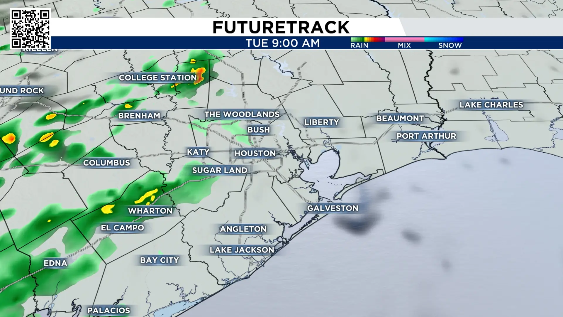
The transition begins this week after a string of dry days characterized by low humidity. While humidity levels are not expected to be excessive on Tuesday, light rain is possible during the late morning and early afternoon hours. These brief showers could be enough to spot vehicles or disrupt outdoor plans. The highest probability for rain is concentrated in the western and southwestern portions of the city. This localized pattern is likely to continue through Wednesday, with rain chances remaining primarily west of downtown Houston.
By Friday and Saturday, the regional weather story will be dominated by moisture arriving from the tropics. Rain associated with Tropical Storm Vance is slated to move into the state of Texas during the start of the weekend. However, the likelihood of significant rainfall depends on whether the tropical moisture couples with a “lifting mechanism,” such as a small low-pressure disturbance. Forecasters noted that the timing of these two systems is critical; if they do not synchronize correctly, the heaviest rainfall could miss the metropolitan area entirely.
Amid the humidity and rain chances, Saturday’s Halloween forecast currently calls for a high of 84 degrees, which would make it one of the warmest Halloweens on record for Houston. The city’s standing record for the holiday was set in 2004, when temperatures reached 88 degrees. Humidity is expected to return in full force by Friday and will likely persist through the remainder of the weekend and into Monday.
Residents are also reminded that Daylight Saving Time ends in the early hours of Sunday, November 1. Clocks should be turned back one hour, as 2:00 a.m. becomes 1:00 a.m. While this provides an extra hour of sleep, it will significantly alter the timing of sunrise and sunset across southeast Texas starting Sunday afternoon.
The most substantial weather reset is on the horizon for Election Day, Tuesday, November 3. A strong cold front is currently modeled to move through southeast Texas during the morning hours. This front is projected to push temperatures back into the 50s for morning lows and the 70s for afternoon highs. Along with the temperature drop, a northwesterly wind is expected to dry out the air and clear the humidity, bringing a more typical autumn feel to the region for the first week of November.