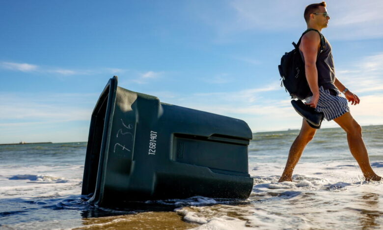
Southern California coastal communities are bracing for multiple days of significant flooding as near-record or record-high sea levels are expected to inundate the shoreline beginning Monday morning. National Weather Service officials have issued warnings for much of the region, specifically targeting Orange and San Diego counties, where the highest high tides are projected through Thursday afternoon.
The surge in water levels is the result of a rare convergence of environmental factors, including the influence of El Niño, a persistent marine heat wave, and an astronomical alignment that occurs only once every two decades. Residents in low-lying areas have been urged to move vehicles to higher ground and secure their properties as seawater is expected to overtop defenses and flood homes, businesses, and critical infrastructure.
In preparation for the incoming tides, municipal crews in Newport Beach and Long Beach have spent the weekend moving massive amounts of sand to reinforce beaches and installing sandbags. These areas, particularly the Balboa Peninsula and the Long Beach Peninsula, have already sustained damage from seawater inundation in recent months and remain highly vulnerable. The National Weather Service in Oxnard noted that while Los Angeles, Ventura, Santa Barbara, and San Luis Obispo counties are under a coastal flood advisory rather than a full warning, isolated structural damage is still possible in the most exposed neighborhoods.
The scale of the projected surge is historic. Total water levels in Los Angeles, Orange, and San Diego counties are expected to reach more than 8 feet above the 1983–2001 baseline. For context, the record seawater level in La Jolla is 7.81 feet, set during the powerful El Niño of 2015. On Sunday, levels there had already climbed to 7.66 feet. At Los Angeles Harbor, the record of 7.92 feet, set in 2005, could be eclipsed this week, with projections hitting 8 feet on Monday and 8.1 feet on Tuesday.
Newport Beach city officials reported that water levels reached 8 feet on Sunday, which was 1.8 feet higher than what would be generated by the high tide alone. Local forecasts suggest the city could see water levels climb to 8.3 feet on Monday morning, eventually peaking at 8.5 feet on Tuesday and Wednesday. This additional height is largely attributed to record-hot ocean temperatures. Scientists at the Scripps Institution of Oceanography have noted that surface temperatures at Scripps Pier reached a high of 77 degrees in August—well above the 70-degree average maximum—and remained around 73 degrees as recently as Thursday.
Beyond the current marine heat wave and El Niño-fueled Kelvin waves, the region is also grappling with the peak of a 18.6-year lunar node tidal cycle and a 4.4-year lunar perigee tidal cycle. These shifts in the moon’s orbit significantly increase tide-generating forces. Experts from the Scripps Institution of Oceanography warn that these cycles will make upcoming “king tides” around Thanksgiving, Christmas, and Martin Luther King Jr. Day exceptionally extreme. If these astronomical high tides coincide with winter storms later this year, the potential for catastrophic coastal erosion and property damage will increase significantly.