Southern California Coast Braces for Severe Flooding as High Tides Threaten Infrastructure

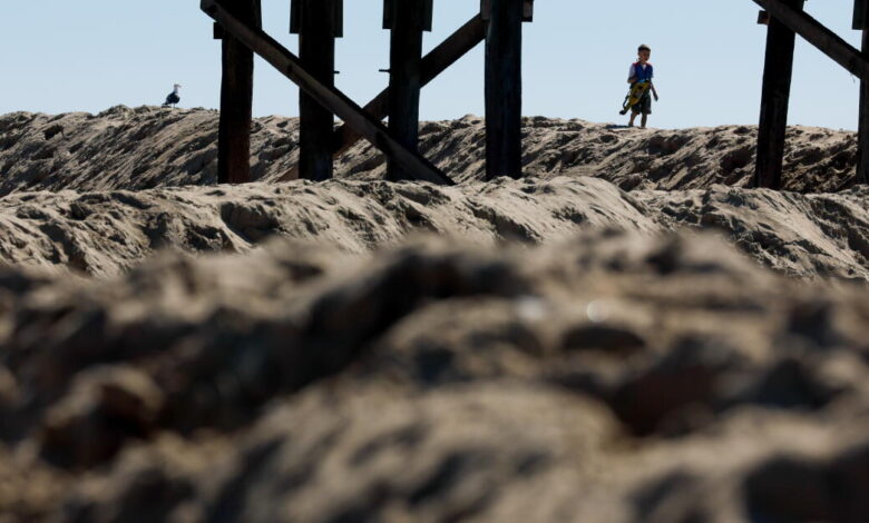
Communities and transit operators along the Southern California coastline are preparing for a severe wave of high tides that threaten to inundate low-lying properties, close roads, and disrupt regional rail travel. The National Weather Service issued flood warnings for Orange and San Diego counties, remaining in effect from Sunday morning through midday Thursday, as morning tides are anticipated to surge between 1 and 1.7 feet above standard projections.
Forecasters warned that numerous roadways face potential closures, while low-lying infrastructure, homes, and businesses could experience significant inundation. The elevated water levels follow early-season storms that have already caused widespread damage in coastal neighborhoods across the region.
The incoming tides have forced immediate operational changes in regional transit. Metrolink announced the temporary suspension of service in southern Orange County from Monday through Friday between the Laguna Niguel/Mission Viejo and Oceanside stations. The vital rail corridor, utilized by both Metrolink and Amtrak to connect Orange County and San Diego along the Pacific Coast, has faced persistent threats from coastal erosion and experienced a multi-day closure earlier in the summer.
Infrastructure concerns extend to major roadways as well. The California Department of Transportation has secured millions of dollars in emergency funding to address a large crack that formed during high tides in early October on a slope beneath the Pacific Coast Highway near Laguna Beach. The unstable area is located near the Moro Beach section of Crystal Cove.
In addition to the warnings in Orange and San Diego counties, the weather service issued flood advisories—a lower-level alert—for coastal areas in Los Angeles, Ventura, Santa Barbara, and San Luis Obispo counties. Peak water levels are projected to arrive on Monday, Tuesday, and Wednesday mornings, reaching between 7.5 and 8 feet, which represents an increase of 1 to 1.5 feet above astronomical forecasts.
Recent weeks have exposed coastal municipalities to intense flooding driven by conditions associated with a potentially historic El Niño cycle. Long Beach and Newport Beach have absorbed the brunt of the devastation, with footage capturing powerful waves crashing over oceanside residences, parking lots, boardwalks, and jetties. Newport Beach City Manager Seimone Jurjis noted that the Balboa Peninsula and the islands inside Newport Harbor remain areas of intense concern.
City teams in Newport Beach have stepped up defensive preparations by reinforcing sand berms, evaluating vulnerable seawalls, positioning sandbags, inspecting storm drains, and staging additional pumps, heavy equipment, and emergency resources. Municipal departments have also coordinated increased staffing to monitor conditions continuously and respond to unfolding incidents.
To assist residents, Newport Beach officials arranged for sandbags to be distributed at three locations while urging owners of private seawalls to bolster their defenses ahead of the peak water levels. These hazardous conditions arrive ahead of the official king tide season, which the California Coastal Commission notes is not scheduled to begin until late November.
Forecasters and emergency officials continue to urge caution for anyone living near the water or visiting local beaches. The weather service advised motorists never to drive around barricades or through floodwaters of uncertain depth. Additionally, beachgoers have been strongly discouraged from walking on jetties and seawalls, or visiting beaches entirely during the peak of the high tides.