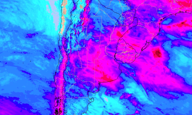
The final week of October is beginning with an active weather pattern as a cold front moves across parts of Argentina, triggering conditions for severe storms, heavy rainfall over short periods, potential hail, and strong wind gusts in sectors of Patagonia and Cuyo. While a large portion of the country will experience a temporary improvement compared to previous grey days, atmospheric instability will persist across multiple regions, bringing renewed precipitation episodes throughout the week.
The meteorological outlook combines a relatively cool start with a progressive temperature increase beginning Tuesday. By the second half of the week, daytime maximums are expected to surpass 24°C across wide sectors of the country, while northern provinces will see temperatures approach and potentially exceed the 30°C threshold.
According to forecasts, the most prominent severe phenomena will develop across central and southern Patagonia due to the cold front’s advance. The collision between this advancing cold air mass and warmer, more humid air ahead of it will favor the formation of heavy showers and thunderstorms. The national meteorological service has issued storm warnings covering the entire eastern portion of Santa Cruz province. Forecasters expect abundant precipitation in brief intervals, occasionally accompanied by hail and strong gusts. Estimated rainfall accumulations range between 15 and 30 millimeters, though localized areas could exceed those amounts. The concentration of heavy rain in short spans remains one of the primary concerns for the region.
Mendoza also falls under active warnings, with localized storms expected to intensify. Consequently, the early part of the week centers attention primarily on eastern Santa Cruz and targeted areas within Mendoza.
As the week progresses, scattered showers will extend toward San Luis, Córdoba, and La Pampa on Tuesday. Precipitation will subsequently reach sectors of La Rioja, Catamarca, and Tucumán, though with lighter intensity. The distribution of these rains will remain isolated rather than reflecting the prolonged, widespread grey conditions seen in previous weeks, meaning that precipitation in a given province will not blanket its entire territory.
By Wednesday and Thursday, additional storms and showers are anticipated across the Pampas region and the northwestern provinces. Consequently, initial regional improvements will coexist with ongoing bouts of atmospheric instability.

A relatively cool environment will dominate Monday and Tuesday, reinforced by southern winds across much of the territory. However, a thermal rebound will commence on Tuesday, driven by increased northern wind circulation and sunnier days. During this transition, substantial differences will persist between morning lows and afternoon highs, creating crisp morning starts followed by milder afternoons.
The most noticeable shift arrives by Wednesday, when maximum temperatures will climb above 24°C in Patagonia and across the central strip. In the northern provinces, readings will edge close to 30°C and may surpass that mark.
Meanwhile, high pressure systems will support mostly stable conditions over eastern Patagonia, the Pampas region, and much of the north during the opening days of the week, yielding drier air, rising temperatures, and prolonged sunshine. Even in these areas, occasional periods of increased cloudiness and weak, isolated showers may develop, meaning the return to stable weather will not be entirely uniform.
Southern and eastern sectors of Buenos Aires province will provide an exception to the broader warming trend. Continuous maritime circulation—featuring an influx of air off the ocean—will keep temperatures more moderate there than in neighboring areas of the central region.